 |
| Driving to Watson Lake was a challenge on several sections of the road. They work very hard to repair the roads and the open window for working is short so sections like this have been repaired but there is still loose gravel and a good deal of dirt to go through. But at least the roads were smooth. |
 |
| Found this big boy munching on the side of the road. |
 |
| Coming into Watson Lake. |
In 1942 while building the Alaska Highway it was common for the US Army Corp of Engineers to put up a directional post at their camps. It gave directions and mileage to surrounding communities and various parts of the world.
While working on the Alaska Highway, Private Carl Lindley was injured and taken to the Army Aid Station in Watson Lake to recuperate. His commanding officer asked him to repair and repaint the directional post. Carl decided to also add his home town sign of Danville, Illinois, since he was homesick. The tradition he started is now known as the world famous Signpost Forest. People from all over North America and the world stop in to admire the thousands of signs and some add their own.
It was very interesting walking through the sign forest checking out the places people have come from. Unfortunately, the weather was rainy and cold this day so we didn't stay as long as we would have liked.
 |
| Elgin is about 10 miles from where we live in South Carolina. |
 |
| Even the Aussies had a presence. |
 |
| Oops! Sorry, no USC sign. |
We spent two days at Watson Lake and while we were there we decided to wash our filthy car. They had a car wash in the RV park and a coin slot which called for either loonies or toonies. We thought that was a silly way of saying either Canadian or U.S. coins but luckily the Captain decided to check with the office first.
 |
The left is a loonie which is a one dollar Canadian coin and the right coin is the toonie, a two dollar Canadian coin. Glad we checked because the coins were required in other places in the Yukon and we wound up having to use them again.
Leaving Watson Lake we headed on to a one-night stop in Teslin, Yukon. The morning was rainy and overcast so the mountains took on a different perspective. We also crossed over the Continental Divide.
 |
| Crossing the Continental Divide |
 |
| The Nisutlin Bridge is the second longest water span on the Alaska Highway at 1,917 feet. Across the river is the town of Teslin where we spent the night. |
 |
Teslin Lake where we parked.
We got into our RV site and started to set up and found out our hydraulic lifts under the rig wouldn't come down. The Captain called Tiffin (the manufacturer of our rig) to see if they could help. After a decent amount of time they led him to a part of the rig that had fuses and one was found to be blown. We were sure hoping that was the issue, but not to be. So our next call was to a repair shop in Whitehorse where we made an appt. for the next morning. We were still able to stay in the rig, it just didn't feel as stable without the lifts down, especially when the slides were out.
|
|
 |
Teslin was a very small town but the police still had a presence here.
 |
The drive to Whitehorse from Teslin Lake was stunning.

 |
| A dam along one of many rivers in this remote country. |

When we arrived at Whitehorse we went to the repair shop and had our HWH lift system checked out. The mechanic was able to quickly find the problem. The motherboard was completely fried and unfixable. The Captain called Tiffin and ordered a new one which they said they could ship the next day to our park in Fairbanks where we had reservations. The person in the office who was taking the information on shipping said she didn't see a motherboard in stock and suggested we call back the next day to ensure it had been shipped. That made the Captain nervous so he called HWH and spoke with them. They suggested replacing the whole box unit rather than trying to replace just the motherboard which made sense. So the Captain ordered one from them, too. Smart move!
When he called Tiffin the next day the service dept. realized they didn't have another motherboard in stock so nothing would have been shipped. So now we are just hoping the one from HWH makes it to Fairbanks. The Captain spoke with a repair shop there and they said they would come over and install it at our site when we arrived.
We had already planned on spending three days in Whitehorse since it is the capital of the Yukon. The population of the Yukon Territory is estimated to be 38,641 with Whitehorse as the home to 29,925. The Yukon is definitely a remote area.
Most of the inhabitants are Native American but in 1993 they changed their name to First Nation and there are 14 separate tribes. The official bird is the Raven, larger and heavier than a crow, and is found in many of the First Nation stories. The climate is usually cold with temperatures dropping into negative figures and a lot of snow in the winter. This time of year a sunny day in the upper 60's is summer.
 |
| We took the pups on a hike in Miles Canyon where the Yukon River runs through. |


 |
We met a young couple who were having a great time hiking with their two dogs and were on a cliff overlooking the river. He was from Calgary and she was from Colorado. He jumped into the water with abandon.
|
 |
| The water was cold but the young lady from Colorado jumped in, too. You go girl! |
 |
| How many pups can say they waded into the Yukon River. |
 |
There was other activity going on in the water but what amazed us was how few people were in the canyon. At home a place like this would be jammed in the summer.
 |

The next two days we went into Whitehorse to see the sights.
The S S Klondike was built in 1929 and was the largest vessel on the Yukon River. The ship had a cargo capacity 50 percent greater than previous boats and could carry over 300 tons. It ran aground in 1936 at the confluence of the Teslin and Yukon rivers and in later years was moved here and rebuilt with a museum.


For over half a century Whitehorse was a company town with most of the land owned by the White Pass and Yukon Route transportation companies. All who camped or settled on the fringes of town were called squatters including First Nations people, railway and shipyard workers, and newcomers looking for a temporary inexpensive home.
During the Alaska Highway construction thousands of soldiers and civilian contractors used Whitehorse as a construction base. Yukoners and newcomers flocked to new jobs and opportunities in the wartime town. Housing was non-existent and the riverfront squatter communities boomed with hundreds of cabins, Quonset huts, shacks, and outhouses popping up in every available space.
In 1953, Whitehorse became the Yukon's capital. With this status came large developments including a bridge to a new suburb across the Yukon River. To many, the area now called Whiskey Flats was unsightly and unsuitable for a modern town. Over the years, there were efforts to displace the squatters who proved remarkably persistent. While some buildings were relocated, many were destroyed without the owners' consent. By 1967, the little community had been replaced by a new park and the S.S. Klondike National Historic Site.
 |
| This picture captures what the area looked like when it was called Whiskey Flats. |
 |
| Today it is a huge park alongside the Yukon River. The weather was wonderful, in the upper 60's and sunny and the park was full of families. The children were having a great time playing in the water. |
|

|
 |
| People having fun with their dogs in the Yukon River. The town and its inhabitants are very careful to keep the river clean because it is their water supply for the whole city. |
|
In 1974, the city limits were expanded from the original 2.7 square miles to 162 square miles making Whitehorse known as the largest metropolitan area in Canada. You are way outside of the actual town and still within the city limits although there is nothing around you but wilderness.
 |
| This log church was built in November, 1900, and it took only two months to build. The rectory was completed by the spring of the following year. The church still has services today. |

The town buildings have many historical murals painted on them.
 |
This immense slab of native copper weighs 2,590 lbs. In 1905, prospectors found the copper on the upper White River, 250 miles northwest of Whitehorse. It is the Yukon's largest copper nugget. In 1958, six men ventured into the wilderness to fetch the nugget. The slab was hoisted 400 feet to the riverbank. Guided by dog teams, the copper was hauled through the wilderness, around two canyons and over a blazed trail to the highway. The operation took five days.
 |
| This was the former station for the 1,600 mile long telegraph line built by the government after the 1898 Gold Rush to access to a new world-wide network of rapid communications. The building built over it is part of the new museum. |
 |
| While in Whitehorse we saw this local food van in an old Winnebago RV with a truck camper on top. Very imaginative! |
 |
| Loved the dog. |
|

How many times have you been at a grocery store and were disgusted by all the carts abandoned around the parking lot by previous shoppers who were too lazy to place them in a cart corral?
Well the Canadian Superstore in Whitehorse came up with an ingenious solution. Remember the loonie and toonie coins.....
 |
| In order to take a cart into the store you need to put in a loonie to unlock the cart. That is a Canadian one dollar coin that costs a Canadian dollar. When we realized we needed a coin the Captain went into the store and got one. He couldn't come back out the same way so he handed the coin to me over a turnstile to get the cart. Okay, now what? I had no idea how to use the coin to remove the cart but luckily a new customer came along and she showed me what to do. You place the loonie into the slot on the cart you are taking and it releases the chain holding the cart in place. |
 |
Well it still took me awhile to figure it out and the Captain was ready to call in the Mounties to find out where I was but I finally got it. After shopping, you take the cart to the cart corral and when you place the loose chain that is in the front of your cart into a slot in the cart that has already been returned it releases the loonie. There were ZERO carts abandoned in this grocery store parking lot.
 |
This is one of Whitehorse's most recognizable landmarks. Placed in front of the Yukon Transportation Museum, it is a CPV 1950's vintage Canadian Pacific Airlines airplane. It is mounted on a pedestal and continually pivots with the nose always pointing into the wind with the slightest of breezes.
While in Whitehorse we visited several breweries and tasted the local beers. And then it was time to move on and head towards Tok and the Alaskan border.
When the glaciers melt on the mountains they deposit a sediment called loess that is a nutrient soil base allowing plants to grow and the mountains start turning green.
|
|
We spent that night at Kluane (Klu-an-e) Lake at an RV park. Kluane Lake had a subtle change in its landscape between 300 and 400 years ago when the Kaskawulsh Glacier advanced across Slims River and closed the drainage outlet of the lake. The water then rose more than 30 feet and found a new outlet at the other end of the lake through the Kluane River and into the Yukon River. What used to be a short trip to the Pacific Ocean for the water flowing from the Kluane Lake is now a journey 10 times longer to the Bering Sea. This is the largest lake in the Yukon at 50 miles in length.
|
|
 |
Lulu (our rig) in a picturesque setting. When we checked in they told us to be careful because they had two bears chase through the RV park a day earlier.
 |
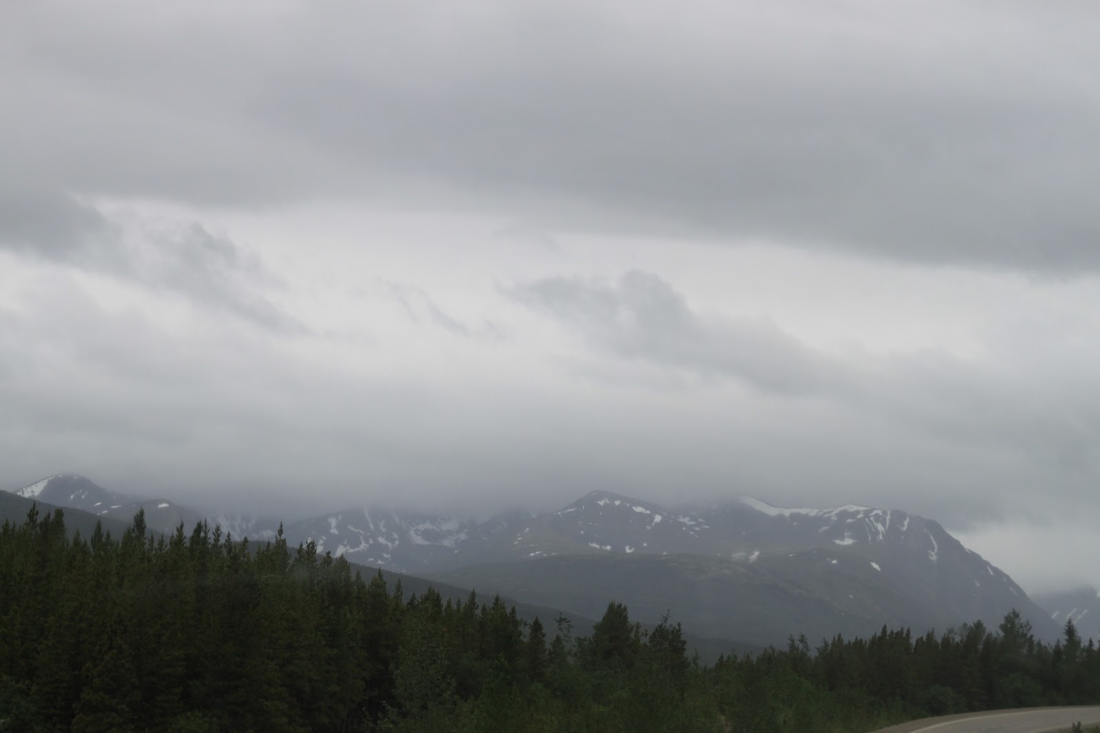
| The next morning we left early because we had the long drive through what they call the washboard highway. The mountains were covered in clouds but still awesome to look at. |
|
|

Slowly the sun came through and the clouds lifted.
 |
The variation in the color of the trees was striking.
 |
Not up for a photo-op I think he was trying to tell me something.

In the picture above we saw a pair of trumpeter swans with their cygnets. They prefer seclusion to raise their babies so they are seldom seen.
|
|
This lovely wildflower is called a Vetch. It was found all along the drive.


And this is called Jacob's Ladder.
|
.
 |
| We think this was a coyote we saw by the side of the road. He looked hungry. |
|

We continued on our drive and made it into Alaska.

The Captain's dream come true.

The back of the 'Welcome to Alaska' sign was nicely decorated, too.

Actually, the border crossing came a little after the 'Welcome to Alaska' sign. They knew there would be a traffic jam if the sign was actually at the crossing station. Although we were in Alaska we still had another 90 miles left to drive to Tok.

Often the road we traveled could best be described as the good, the bad, and the ugly. About the last 30 miles out of the Yukon and the first 20 miles into Alaska were a major challenge.
.

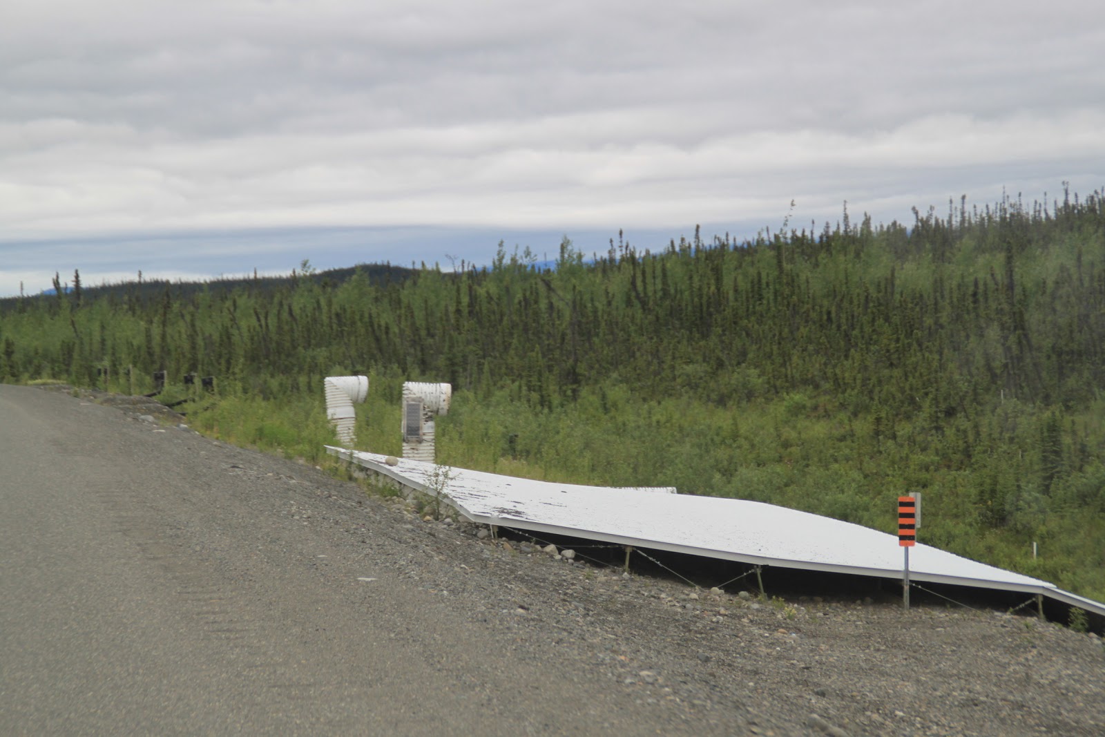
The permafrost causes the road to heave so it is constantly being repaired but you have to be very careful for unmarked areas.


 |
Check out the electrical poles along the way. Even they were struggling.

The U.S. government along with Canada is continually working on scientific ways to prevent the heave damage caused to the roads by the permafrost. This is one example they are testing to see if they can prevent the ground from freezing under the road.
|
 |
| The Captain thought this was a great picture to show you how much the rig tossed and turned on the washboard highway. And we were going very slow most of the way. Highest speed was around 45 on nice stretches but in the bad areas he was only going 20-25 mph. It made for a long day of driving. |

The landscape became more stark as we traveled because of the permafrost.


The trees grow in all different directions trying to stand but the root system struggles in the frozen ground.

Finally, crossing the Tok River.
We made it into Tok (Toke) to spend the night and get a well needed rest. The drive took six hours. |
In the distance the mountains are called the Alaska Range.
The pups were so glad to finally come to a stop for the day.
Please forgive the change in some of the font styles in this blog. Communication has been touchy and our Internet and cell service poor and many days non-existent. However, I do take full responsibility for any typos and improper verbiage which happens more often than not :)
So we can now say we finally made it to Alaska. Tok is a friendly little town that calls itself, "The Main Street Through Alaska". It is the only town in Alaska that the highway traveler must pass through twice - once when arriving in the state and again on leaving the state. We went to a local restaurant in town and had a nice dinner and a few drinks. The Captain needed it. But I still can't figure out why every time I say the name of the town, Tok, he starts inhaling deeply.......... Peace!
|
|


No comments:
Post a Comment