We stopped in Williston, ND, for an overnight on our way to Montana. Williston is a town that has been hit by the oil drilling bug. There are oil rigs everywhere, dust and dirt everywhere, transient workers everywhere. Our one night stay was right off Hwy 2 and listening to the trucks all night , esp. those using jake brakes, was interesting......and this was the best RV park in the area :(
 |
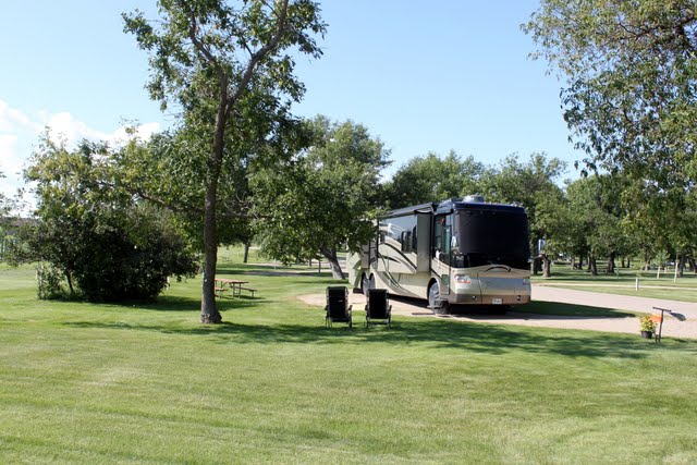
| Good looking rig near Williston, ND |
 |
| Rolling hills and flat land of ND and eastern Montana |
Just outside of Williston we stopped at the Missouri-Yellowstone Confluence Interpretive Center. This is where the Missouri and Yellowstone Rivers meet. We also toured the grounds of Fort Buford which is an old Army base.
 |
| Confluence of the Missouri and Yellowstone Rivers |
 |
| Hard to tell which river is which.....just looks like a lot of water to me! |
 |
| Fort Buford |
 |
| Fort Pickens |
After that we left for Montana and our stay at Fort Peck Reservoir Downstream Campground. This is an amazing place so I will bore you with a little background.
 |
| Fort Peck Reservoir |
 |
| Our campsite at Fort Peck Downstream Reservoir |
 |
| The dam in the distance.....this huge reservoir is 134 miles long and 220 feet deep with 1500 miles of shore line. |
 |
| Another shot of the dam with the four control towers. They are used to control the flow of water from the Missouri River to the underground tunnels which move the water through the dam. Each tunnel can individually handle the normal flow of the river. |
 |
| View of the main highway on top of the dam |
 |
| Massive boulders that were brought in to help support the shoreline. |
The Fort Peck Dam project was authorized in 1933 by Franklin Delano Roosevelt who hoped it would serve the dual purpose of providing jobs for a Depression plagued workforce and also provide flood protection from the Missouri River that had been a concern since the 1860's. Two weeks after approval there were 50 men at the site and within 6 months there were hundreds. Actual construction was started in 1934 and finished in 1939. That doesn't seem like a long time to me and when you see the enormity of this project it is truly amazing.
- Fort Peck Reservoir is the largest earthen dam in the US
- It is the largest hydraulically-filled dam in the world
- The width at the base is 4900 feet
- The width at the crest is 50 feet
Hydraulically-filled means the dam was created from a mixture of watery sediment dredged from the bottom of the Missouri River. The work involved dredging boats that sucked up the sediment and pumped it through miles of pipeline to the dam site. Since there was no equipment of this type in the United States, shipbuilders and engineers came to Fort Peck from all over the US to design and build all the equipment and boats on site.
To build the dam, rock had to be brought in from 30 miles away so the workers built a 2.5 mile railroad spur to haul the quarry stone, gravel, and field stone to the site. Electric power lines had to be built to bring power to the site. Dredging pipes running for miles were built and maintained to move the sediment from the dredge boats to the dam. Innumerable problems were encountered, studied and solved, a tribute to the ingenuity and innovation of the Corps of Engineers and the people who worked on the dam. The crews worked 24 hours a day often in unbearable conditions doing mostly manual labor. In 1936 temperatures were recorded from -61 degrees in February to 114 degrees in July. When the project was finished sixty workers had lost their lives building the dam. Impounding the Missouri River was a gargantuan task which resulted in the world's largest dam, at that time.
The town of Fort Peck was built by the Army Corps of Engineers in order to have a place to house the workers in the wilderness. Many of the men lived in 50 bed barracks and each barracks had its own cooking crew. We saw a menu from the 30's and the meals were very good with quite a variety especially for men who had been starving before they came to Montana for work. The crews worked 8 hour shifts for 40 hours a week. In their free time baseball teams were started and a movie theatre was built that was open 24 hours a day (it's still in existence and open today in the town of Fort Peck).
It was even more difficult for the men who brought their families with them. Homes were ramshackle, often not more than lean-tos and the families often suffered. Other little towns sprang up to accommodate these families, 18 boom towns in all, in the vicinity of the dam site. Soon there were almost 11,000 workers for the dam plus another 10,000 merchants, saloon keepers, etc. to help support the workers and the project.
Along with the sediment that was used to create the earthen dam, a steel cutoff wall made from 34 million pounds of steel sheeting was built that runs the entire length of the dam. The steel was pounded deep into the floor of bentonite and shale below the dam and heaped with impervious clay to prevent under-seepage and potential disastrous effects.
Three miles from the dam is a spillway to relieve the reservoir if it becomes too full. The spillway had only been used four times since the dam was completed and this year was the fifth. The reservoir was at its highest level ever this year because of all the rain and snowmelt coming from the mountains. The spillway itself is a mile long and all 16 release gates were in operation. We were able to walk all the way down the spillway to take these photos.
 |
| View of the mile long spillway. Two years ago the land above the spillway was completely dry. The spillway is three miles from the actual dam holding back the Missouri River. |
 |
| One of 16 gates only open a few inches to relieve water from the reservoir. |
 |
| Looking down the spillway from the top. |
 |
| Halfway down the spillway the water is getting more turbulent. |
 |
| Water at the bottom of the spillway. It is moving at 65 miles per hour. |
 |
| Very dangerous water at this end. |
 |
| Through the spillway and rejoining the Missouri River. |
The Fort Peck Dam project was completed in 1939. When it was finished most of the people left and almost all the boom towns disappeared. All the ships, railroad lines, and equipment used to build the dam were disassembled and sold or hauled away. Many of the people who worked on the dam stayed in Montana and moved to other small towns.
In 1941 the first powerhouse was built on the dam and a second one was begun in 1958. We were allowed to tour the powerhouses and they were also amazing. We saw the turbines that run the powerhouses and were even allowed to touch a turbine as it was moving. Very strange.....the metal was warm and extremely silky to the touch but not oily. There are four surge tanks that each hold over 2 million gallons of water. They are used in the event of a power failure to take a water surge and prevent damage to the powerhouses and dam. We were allowed into a room housing one of the surge tanks and it was 65 feet in diameter and ten stories high. We were at the bottom staring up and it sure was a spooky feeling knowing that much water was above us. The powerhouses are very productive with total annual power generation at 1.1 billion kilowatt hours.
 |
| Powerhouses built later on the Fort Peck Reservoir Dam |
Brett would have loved to have taken pictures of all the neat stuff in the powerhouses but unfortunately since 9/11 no cameras, purses, or anything else is allowed into the facility and they also require a photo ID before you can go in.
There have also been many dinosaur bones found in this area. We visited the Interpretive Center and found out that 65 million years ago this area of the country was an ocean with tropical climates. It wasn't until the Ice Age that the land changed and the Missouri River was rerouted to create what we have today.
 |
| The older one is on the left. |
 |
| Cool place for kids to visit. |
A few other pictures we caught along the way:
 |
| Osprey near the spillway. |
 |
| Their nest atop an electric pole. |
 |
| Think he's having a good time ? |
 |
| Yard art on a lawn in Fort Peck created from the stump of a tree. |
 |
| Twin powerhouses on the dam at twilight |
Peace to all !
For our trivia buffs:
Where is the geographical center of the United States?
Rugby, North Dakota
For additional pictures go to:
https://picasaweb.google.com/118305421752208972550