|
| We headed out in the rig to Arkansas from Oklahoma. Desi wanted to know, "Are we there yet?" This was after 15 minutes of driving. |
 |
| Lucy plopped her body on the Captain's desk knowing the ride would take awhile. |
 |
| Along the way we saw miles of wild trees in bloom letting us know spring was just around the corner. |
 |
| We arrived in Ozark and headed through downtown towards our RV park. |
 |
| Ozark is the county seat which is why it is such a vibrant town, |
 |
| The local high school just finished a 4A basketball tournament and businesses were rooting for the home team. The team's name, Hillbillies, is the only one in the nation . |
 |
| We passed one of the main restaurants as we came into town. |
 |
| Crossing the Arkansas River we came to our RV park called Aux Arc. The name comes from French cartographers who mapped the Arkansas and Mississippi Rivers. Aux means 'large' and Arc is 'bend' so the name is for the large bend in the river. In French, aux is pronounced 'oh' unless the word following it begins with a vowel and then the "x" becomes a "z" sound. Aux Arc or 'oh zarc' became Ozark. |
 |
| Our spot was right on the Arkansas River and we saw many barges being moved through the waters. |
 |
| The river is dammed near the park so the barges go through locks to get from one level to another. At night you can hear the motors of the tugs as they move the barges forward. Across the river is an active railroad line with trains moving at all hours of the day and night. The trains travel through downtown Ozark so the whistles are blaring and over the water the sound is quite loud. |
 |
| The bridge and town is very pretty at night with everything lit up even if it is a little noisy. |
 |
| The area is also very popular with the fishermen. |
 |
Downtown Ozark is an old city with lots of old buildings.
 |
| St Mary's Church built in 1879. |
|
 |
| But they did have a modern day Butterball plant. |
 |
| A local recommended the Rivertowne BBQ so we went there for lunch. |
 |
| It fit the town. |
Ozark is also near the Arkansas Wine Trail. We didn't know the state had a wine trail but they have four wineries so we jumped into the car to check them out.
 |
| The first one was ten miles outside of town and when we got there we realized we hadn't dropped off our garbage at the dumpster on the way out of our RV park. It's amazing how strong plastic really is. The Captain was wondering why he was getting odd looks from fellow drivers on the highway as they passed by us. |
 |
| After a good laugh we knew we were ready for a wine tasting! |
 |
| The wine was great and so were these gourds decorated by a local artist. |
 |
| Taking 18 to 21 steps, the gourd has all the dirt and mold scraped off and then is thoroughly washed. It takes 3 months to a year for the gourd to dry before it is ready for designing. The gourd is then cut, designed, and color is added using permanent ink and dyes before being sealed. No two gourds are ever alike. They dry to a thick woodsy shell much the same as wood but denser and not as porous as clay. This one is going to look lovely in our family room ! |
 |
| On the way to the next winery the roadsides were covered with blooming daffodils. |
 |
| This winery was our favorite. It has been around since 1880 and they had some wonderful wines. Unfortunately, they don't ship their wines out of state. |
Another day we took a drive over to Fort Smith, Arkansas. Our first stop was at the visitors center to see what the town had to offer.
 |
| To our surprise, the Visitors Center was a former brothel. |
 |
| It was quite the place, then and now. |
 |
| This was the room belonging to the owner of the brothel, Miss Laura. |
 |
| The main entrance hall. |
 |
| The sitting room where the guests were met. |
 |
| Beautiful stained windows. |
 |
| The landing between the first and second floor. |
 |
| The ladies were 'checked' every few months by a local doctor. But only for tuberculosis. |
 |
| Each one of the ladies had their own room with their name etched in glass above the door. |
 |
| The rooms were very fancy. |
 |
| And so were the clothes. |
 |
| A picture taken of some of the ladies who worked in the brothel. |
Well after that I figured we had pretty much seen all that was necessary to see in the town but the Captain wanted to see the fort. Fort Smith lies on the Arkansas-Oklahoma state border at the junction of the Arkansas and Poteau Rivers. The city began as a western frontier military post in 1817 and later became known for its role in the settling of the "Wild West" and its law enforcement heritage. Today it is the second largest city in Arkansas.
 |
| Fort Smith was founded in 1817 by the U.S. Army to contain a volatile Indian feud. It later served as a major supply depot for military posts and as headquarters of the Federal Court for the Western District of Arkansas. For over 80 years, the federal government used Fort Smith to establish and maintain law and order in the Indian Territory (present day Oklahoma). |
 |
| In 1872, the Commissary was converted into offices and living quarters. The first floor was partitioned to accommodate a family of six. |
 |
| The flagstaff stood tall so that its flag could be seen for miles. To attain a height of nearly 100 feet, the army joined two poles in the same way that ship masts were built. This flag is a replica of the 37-star flag that was flown here until the Army closed Fort Smith in 1871. |
 |
| Over a 24 year period, eighty-seven men died on the gallows in Fort Smith. While Judge Isaac Parker sat on the bench, 160 people, including four women, were sentenced to hang. Just over half received a reprieve from execution through pardons, commutations, reversals or acquittals on appeal, or death in jail. |
 |
| In 1825, the Arkansas River divided the land between the Arkansas Territory and a vast domain was traded to the Choctaw Nation for their ancestral lands to the east. Fort Smith's location at the edge of Indian country was a major factor in its evolution and growth. The Choctaw lands remained part of Indian Country until 1907 when the state of Oklahoma was established. |
 |
| Beginning in the 1820's, the United States government forced large numbers of Cherokees, Chickasaws, Choctaws, Muscogee, and Seminoles from their ancestral lands across the Arkansas River to the new Indian Territory. The primary reason for this removal was the insatiable desire of U.S. citizens for Indian lands. Under the Indian Removal Act of 1830, the government exchanged tribal lands in the east for new ones in the west. The subsequent treaties, many of them illegal, forced migration and horrendous Indian suffering. The removal process today is remembered as the Trail of Tears. |
Needing exercise, we decided to take a drive up to Magazine Mountain which is part of a scenic drive south of where we were staying.
 |
| We drove through a quaint little town called Paris that had a really big courthouse. |
 |
| A view from Magazine Mountain. |
 |
| There were many rock formations. |
 |
| The pups loved the area and the creeks where they could get a drink of water. |
 |
| When Desi got too hot he just laid down in the creek bed to take it all in. |
 |
| Near the top of the mountain was a beautiful lodge so after giving the pups a good workout we stopped for lunch. |
 |
| From the lodge, the view is of Blue Mountain Lake, a U.S. Army Corps of Engineer reservoir on the Petit Jean River. Beyond it are the Ouachita Mountains. |
 |
| The lodge was very nice, too. |
 |
| Looking for more country, we picked another day to take a scenic drive into the Boston Mountains to see two specific sights. |
 |
| The 'scenic drive' was treacherous with quite a few trucks on it. |
 |
| The road constantly twisted and turned so we did not make very good time. |
 |
| But we finally made it to our first stop, the Alum Cove Natural Bridge, and headed down a trail. |
 |
| The way down to the natural bridge was a series of steps intermingled within a trail of rocks and roots. |
 |
| The arch is a bridge you can walk across made up of layers of rock and shale. |
 |
| You could continue down the trail and walk underneath the bridge. |
 |
| The sides were quite steep.........that little black speck at the bottom is Desi. |
 |
| We went further down the trail and found some other areas with neat rock formations. |
 |
| Unfortunately once we got to the bottom we had to hike back up again. That was fun.........I only had to stop and catch my breath three or four times :) |
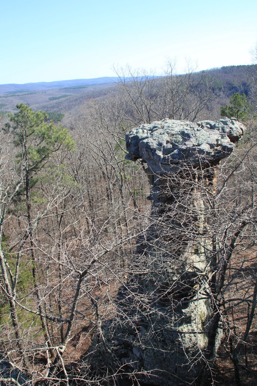
After a quick lunch at a picnic table we drove on to the next sight, a place called the Pedestal Rocks.
 |
| The area was well named and the hike (about two miles) was well worth it. |
 |
| The rocks jutted out everywhere. |
 |
| Trees worked very hard to maintain their presence among the pedestal rocks. |
 |
| The mountains were just starting to turn green......I guess we were a little too early. |
 |
| A few places had wooden barriers but most did not. There were signs warning parents to keep their children away from the edge. |
 |
| Some of the rock formations looked like mushrooms. |
 |
| This one looked like a chimney. |
We had fun in Ozark but after a week of hiking and relaxation it is time to move on to the next big city, West Memphis, Arkansas. In case you don't know, West Memphis, Arkansas, is just across the Mississippi River from Memphis, Tennessee and Graceland, the home of Elvis Presley. So what can I say.........we're All Shook Up !!! Peace!