 |
| A Massachusetts state police armored vehicle we saw on the interstate. Wonder what they use it for? |
 |
| An impressive roundabout as we got closer to our destination of Cape Cod. |
Now let me be the first to admit that I thought Cape Cod was a town rather than an island connected to the mainland by two bridges over Cap Cod Canal. I should have known better but I never really thought about it before. It is a geographic cape/island and independent land mass separated from the mainland that juts out into the Atlantic Ocean. The Cape territory is divided into 15 towns with many small villages.
 |
| We stayed at an RV park in a town called Eastham a good distance down the coast. Note where Martha's Vineyard and Nantucket Island are farther south of the Cape. From Chatham, close to an hour's drive from where we were staying, the boat ride to these two islands was 1.5 to 2.5 hours each way. |
Cape Cod is 339 sq. miles and is one of the biggest barrier islands in the world shielding the Massachusetts coastline from North Atlantic storm waves. Much of the east-facing Atlantic seacoast consists of wide sandy beaches and in 1961 was made part of the Cape Cod National Seashore by President John F. Kennedy. This protected the area from private development and preserved it for public use. The locals in Cape Cod are very protective over their beaches and we were warned when we arrived at our RV park that there are strict laws regarding pets on the National Seashore. So strict that there are hundreds of volunteers who monitor the seashore for recalcitrant pets (and their owners) and if you are caught breaking the rules the fines are quite stiff. With that said, we decided to avoid the National Seashore and opted for the other side of the island on the Cape Cod Bay. This area is friendlier and we were able to get our pups exercised.
 |
| There is only one main road on Cape Cod with many miles only two lanes. These barriers were put up over a 13 mile distance to prevent people from passing so driving can be slow at times. |
 |
| We stayed at a nice laid back park called the Atlantic Oaks. |
 |
| Saw this 1936 Dodge panel truck for sale. They only wanted $27, 500 for it but, hey, it still had the original motor in it. |
 |
| A bay in the area of Eastham. |
 |
| Taking the pups on a hike in a local county park. |
One of the things we wanted to do while visiting was to drive to Provincetown which is on the very tip of Cape Cod. This is a really neat town with all kinds of shops, restaurants, and boat trips to see the whales.
 |
As we got into P'town (that's what the locals call Provincetown) we saw this large monument. It is the Pilgrim Monument and was built between 1907 and 1910.
|
 |
After many months at sea, the Pilgrims spent an additional 5 weeks on the tip of Cape Cod while the Mayflower Compact was written and signed. The Mayflower Compact is the first document of a democratic society in the New World and the Pilgrims refused to travel any further until it was completed.
 |
The monument is 252 feet tall and is the tallest all-granite structure in the United States.
|
|
Down near Provincetown Harbor we found a great deal of people and a lot of action. The children may be back in school but the gap was filled by the retirees. They were coming in by the busload and there were also ferry crossings between P'town and Boston or Plymouth on the mainland.
 |
| Lobster fishermen were already unloading their traps from the bay in preparation for the winter. |
 |
| Lots and lots of commercial fishing boats were just sitting in the harbor. |
 |
| But the ships that take the tourists out to see the whales were still in business so we booked a trip. |
 |
| Neat looking sailing ship. |
 |
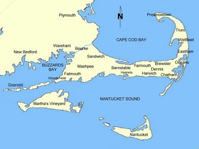
| P'town Harbor |
On our whale watching boat we saw three different lighthouses as we left the safety of the harbor and rode out to to an area called the Stellwagen Bank National Marine Sanctuary. It is a marine sanctuary 25 miles east of Boston and 5 miles north of Provincetown, Massachusetts. The federally protected sanctuary is 843 square miles with an underwater plateau stretching 19 miles north to south and six miles across. The bank is 100 to 200 feet below the surface with surrounding waters 300 to 600 feet deep. Our boat trip took about an hour to reach the area where the whales and other sea life feed.
 |
| The steep sides of the plateau cause deep-river currents to rise up when they hit the bank and this upwelling brings with it nutrients and minerals from the bottom. Over 130 species from numerous classes of the animal kingdom call the bank home even if only temporarily. Many types of whale inhabit the area at different times of the year including humpback whales, fin whales, and North American Right Whales. |
We took many, many pictures of these beautiful mammals. It was a beautiful, warm day to whale watch and the big ones were very active. Even the tour guide said it was one of the best days they had seen out on the water.
 |
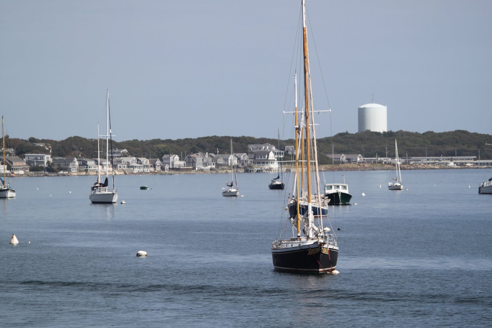
| Two whales. |
 |
| The tail of one of them. |
 |
'Thar she blows! ' When a whale comes to the surface it breathes out the"old" air very quickly. The nose of the whale is on top of its head so when it empties its lungs the air can travel 10 to 40 feet. Since the air from the whale is usually warmer than the air just above the surface of the ocean the water vapor condenses. So the spout you see is not a fountain of water, but rather, a stream of warm air being forced out of the whale's lungs.
|
 |
| A mother and her calf. The mother whale carries the calf for one year. After birth the calf will stay with her for another year until they part and go their separate ways. |
 |
| One of the whales starting to surface. |
 |
| You can see the blowhole on the top of its head. |
 |
| They got so close to the boat. I swear this one was smiling at us. |
 |
| When the whale is heading for the surface you will see a bright green hue which is caused by the plankton rich waters being forced up by the whale. The guide told us to watch for this color and we would see a whale coming up in the vicinity. |
 |
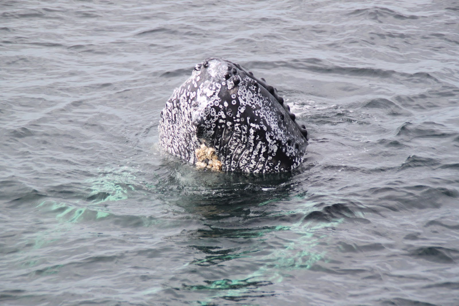
| Note the barnacles on the whale. |
 |
| The whales were often in pairs. |
 |
| Another tour boat was right near ours as the whales entertained. |
The Captain had a better camera than I so he was able to take a series of pictures quickly. If you scroll through the next set of pictures it shows the action from the whales.
 |
| As the afternoon wore on there were more whales and they became more active. |
This next series of pictures show the whales doing some amazing tricks. They would leap up and smack their tails very hard onto the surface of the water again and again. Our guide said scientists are not sure why they do this but they have narrowed it down to three possibilities; 1- the way a whale communicates with another whale in the area; 2- to dislodge barnacles that have attached to the whale's tail; or 3- the whales do it for fun and to entertain the crowd. When their tails hit the water it sounds like thunder. Once again scroll quickly through the photos to see the action.
 |
| The whales were amazing and the boat trip was well worth it. |
 |
| They were watching us as much as we were watching them. |
 |
| And they also performed some water ballet for us. |
 |
| They were performing for a large crowd on this day. |
 |
| And then we were out of time so with a few final salutes from these amazing mammals the boats turned around and took us back to shore. |
 |
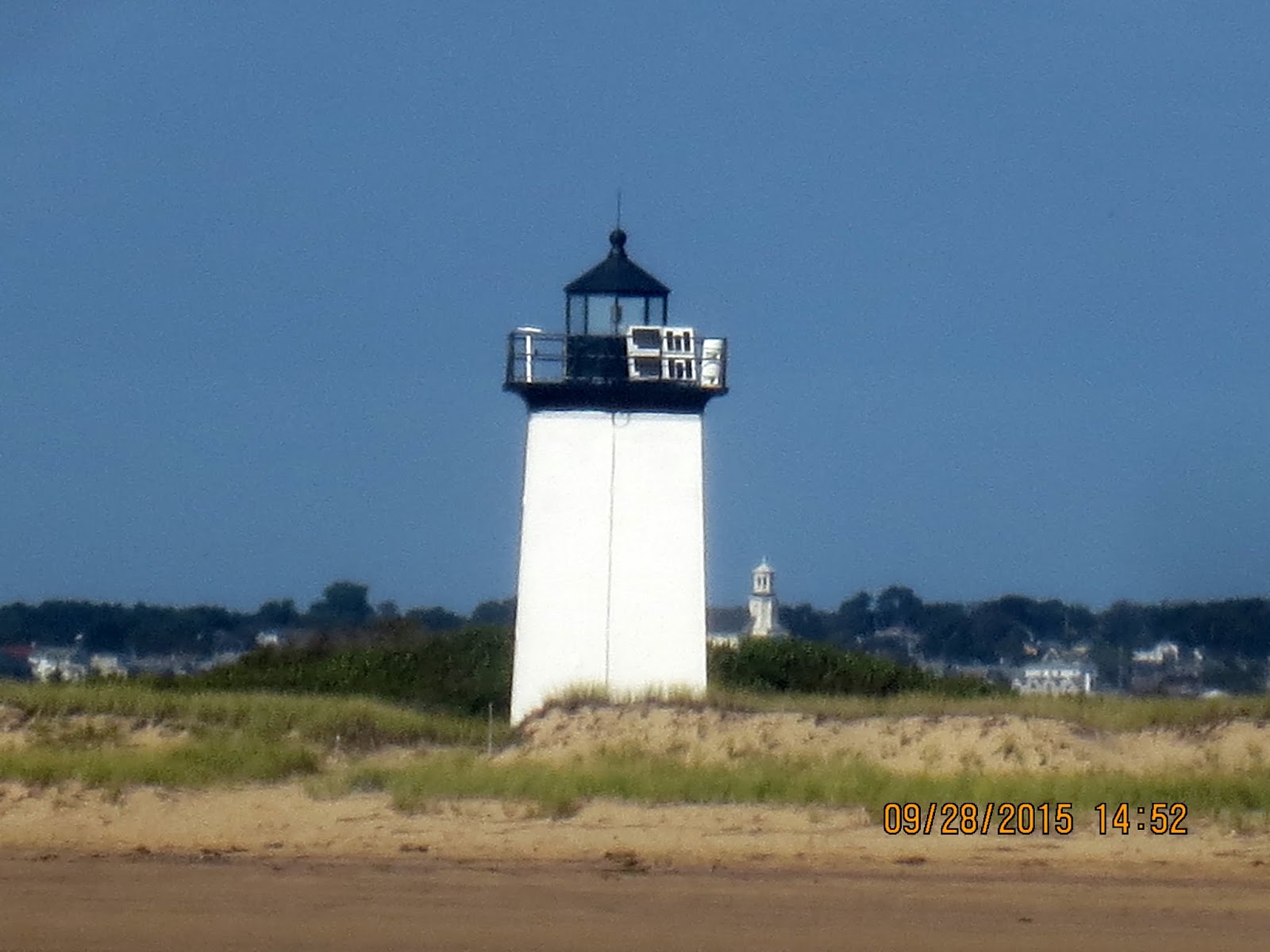
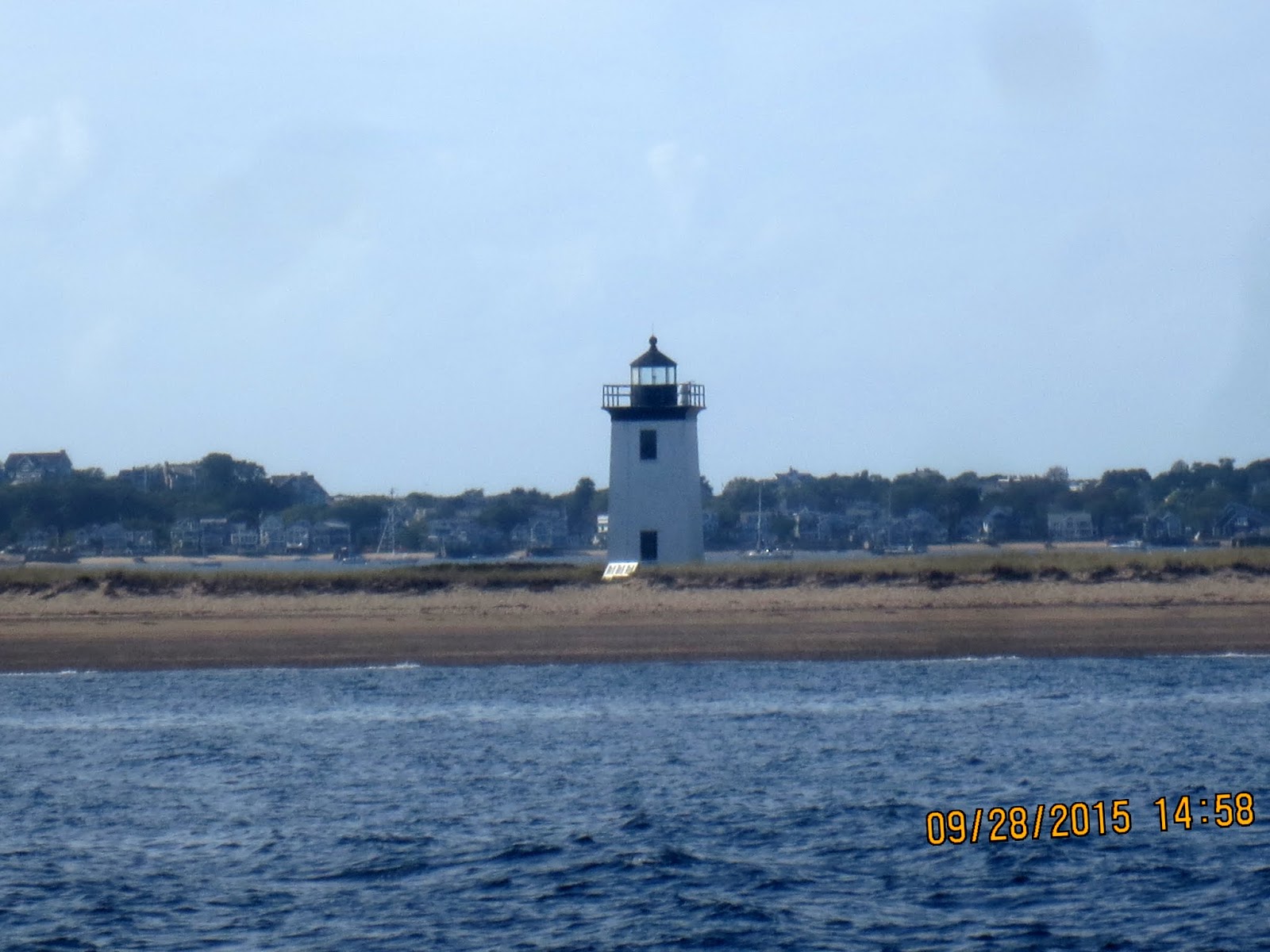
| On the ride back we saw the three lighthouses that were used to protect the Cape. |
 |
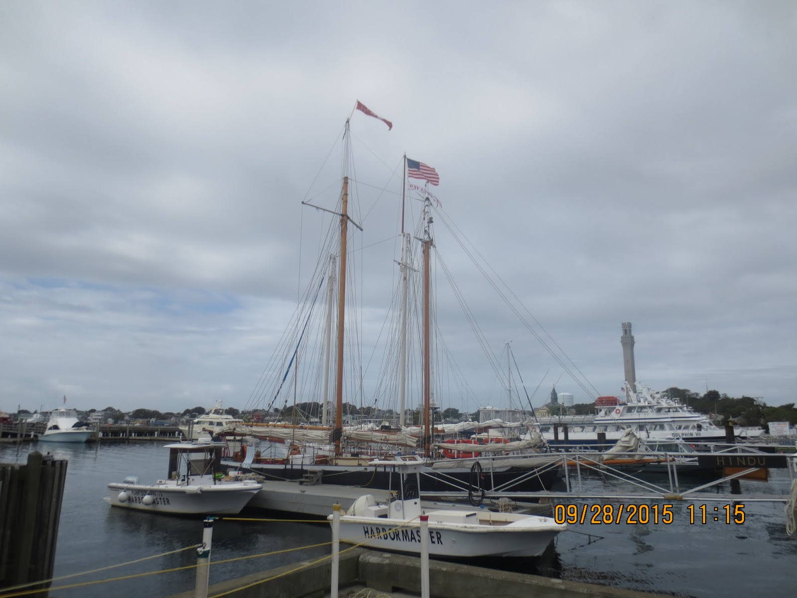
| A view of P'town from the harbor. |
 |
| This building houses fire trucks and it sits on the end of the wharf. |
We had such a good time in Provincetown, and it is such an interesting place, that we decided to go back the next day with the pups to check it out. P'town is a small coastal resort town with a year round population of under 3,000 people. During the summer the population can go as high as 60,000 and it is known for its beaches, harbor, artists, tourist industry, and its status as a vacation destination for the LGBT community.
One of the nicest things about P'town is that it is very dog friendly. While the Cape Cod National Seashore borders right up into P'town, there are still trails and beaches that allow the dogs to run free. Most all of the restaurants with outdoor seating allow dogs and all of the shops allow dogs inside.
 |
| Lucy and Desi got to swim in P'town Harbor. |
 |
| That was a good way to cool them off and get rid of excess energy so we could look through the shops later. |
 |
| Loved this sculpture. It's called "Tourist". We don't look like this, do we??? |
 |
| The downtown area of P'town is spread over many blocks so one can do a good deal of walking. |
 |
| We were looking for a place for lunch but the Captain decided to avoid this one. |
 |
| We finally picked the Governor Bradford Restaurant and had a nice meal that we shared with the pups and then we toured the town. |
 |
| There were some lovely older homes right off the main street. |
 |
| The Captain wanted to go into this shop but I said 'NO'. Just Kidding :) |
 |
| Hmmmm |
 |
| There is a pet store in P'town that will also board your dog for a day or more if you want to go somewhere. We needed dog food so we stopped in. The delicatessen counter had wonderful looking goodies......all for dogs. And boy, were they pricey! |
One of the reasons we went up to New England this summer was to view the trees changing color as fall neared. We didn't know the area would have an exceptionally long warm spell and then with the weather becoming poor very quickly we didn't see many color changes.
 |
| Changes were just beginning to happen when we left the Northeast. |
Tourists this time of year in New England are called 'Leaf Peepers'. I don't think it is a compliment. I know the businesses in the Northeast like having us there but I think the average citizen would prefer it if we just stayed home. Everyone we talked to had an opinion as to why the leaves change color and what hadn't happened yet to cause it. Some of the reasons we heard were that it was too warm, there wasn't enough rain, and the nights weren't cold enough yet, so I decided to do a little research, and yes, I'll try to be brief.
 |
| Plants take water from the ground and carbon dioxide from the air. They use sunlight to turn water and carbon dioxide into oxygen and glucose. Glucose is food for energy to help the plant grow. Photosynthesis is what causes the water and carbon dioxide to turn into oxygen and glucose using a chemical called chlorophyll to make it happen. Chlorophyll is what gives plants their green color. As winter comes, there is not enough light or water for photosynthesis so the plant starts to shut down its food-making and the green chlorophyll disappears from the leaves. |
 |
| As the green color fades away we start to see yellow and orange colors. These colors were always present in the plant but were covered up by the green chlorophyll. |
 |
| The plants with reds and purple colors are caused by glucose. Glucose is trapped in the leaves after photosynthesis stops. Sunlight and cool nights cause the sugar trapped in the leaves to turn into reddish tones like you see in many maple trees. |
We had some other wonderful plans for the Cape Cod area but it wasn't meant to be. The day after our trip to P'town the bad weather came in, a major storm front from Canada that hit the Northeast with heavy rain and 40 mile per hour winds. About the same time, Hurricane Joaquin was in the Southeast and expected to move up the coast to New England. Trying to survive in a rig with heavy rain and high winds is not fun so we left Cape Cod early the next morning and started heading inland. We had to cancel our reservations for our stay in Rhode Island and Connecticut since both states were also in harm's way. We drove to Albany expecting to head south the next day. Then we found out that South Carolina was flooding badly and it wasn't a good place to be driving to. We stayed in Albany, NY, for several days and drove down to Roanoke,VA, for a few more days. Keeping in touch with family and friends, we were told that the roads we would need to take to get to our house were all closed and a curfew had been placed in our county and many other parts of the state. The RV parks we stayed at were jammed because there were many travelers from Florida who were also trying to get home.
Finally, we got the okay and drove home. Our house was fine and the lake we live on had some water flow over the top of the dam but thanks to our great neighbors, Gary and Ann, who monitored the lake and had another overflow in place to release extra water, we did not have a failure like many of the other dams in the area and throughout Columbia. However, two roads in our area did have damage and were closed to traffic. After we made it home we walked over to take a look at them.
 |
Grey Fox Road, a residential street near our house, was damaged when the water from Twenty-Five Mile Creek flooded over it. There is a small bridge further up the road which held and they are saying this road will be fixed soon and open to the public.
|
 |
| Water was still showing along the roadway where the creek overflowed. |
 |
| The main thoroughfare near our house is called Pine Grove Road and it took a major hit. Notice the car in the background. Our county enacted a curfew along with most of the Midlands in South Carolina but sometimes people think they can still pass. The car was traveling at night and the driver went around a barricade. They say the water was between 4-5 feet over the roadway and moving fast. The car was swept off the road and flipped over. A woman in the car was saved when a deputy sheriff from the county heard her cries as he was patrolling the area. They found her clinging to the tire of the car. The man in the car drowned. |
 |
| This is how the road looks now. |
 |
| The infrastructure has been washed away. |
 |
| It will be a long time before it is opened again. Some people are estimating a year because the damage is so extensive. |
 |
| The overturned car is still present because the road isn't safe enough to bring in a tow truck. |
 |
| You don't realize how dangerous water is until you see what it does up close. |
So I'm sorry to say that is all for our trip to the Northeast. We had beautiful weather, some great adventures, and met many nice people. We didn't get to see it all but we did get to see a great deal. Rhode Island and Connecticut will have to wait until our next trip to the Northeast. It's good to be home again with the holiday seasons fast approaching and we are looking forward to spending time with our family and friends here in South Carolina. Peace!
 |
| And a beautiful final sunset we caught on our trip home. |


