
We stayed for three days at Grahams Island State Park at Devils Lake, ND. The lake is a closed drainage basin, marked by periods of fluctuating water levels. Because of heavy rains and snow melts the lake has continued to rise over the past 20 years and flood out the surrounding land. Over 200,000 acres of farmland has been lost along with farmhouses, lake homes, and roads and bridges.
Brett said if he had known what it would take to get here, he probably would have gone to another campground. With that said, it was certainly worth the effort. When we contacted the state park to get detailed directions we were told there was some construction on the main highway from the town of Devils Lake to the park. That was all they said. When we got to the construction areas (note: I'm using plural) we wound up on several miles of long dirty, dusty, road with pilot cars taking us over a section of highway that they were trying to build up with dirt to stop the advancement of Devils Lake.
 |
| Road construction on the major highway trying to stay higher than the lake. |
 |
| A farm that was abandoned due to rising lake waters. |
 |
| Silos surrounded by water |
 |
| View of the farm from the RV while driving on the road construction. |
We traveled through two sections of road construction for several miles with the lake showing on both sides of the dirt road. The highway crews are working 24/7 bringing in dirt to elevate the current highway above the encroaching water. They have 100 trucks hauling in dirt day and night to build up the road but it keeps raining and the dirt is washing away. During a storm there can be 6-8 foot waves on the lake which undermines the dirt work.
Grahams Island State Park is connected by road over an elevated embankment that can sometimes be treacherous. We made it to the causeway not realizing how narrow it would be. Going across it was scary but there was nowhere to turn around so we were committed......while we held our breath.
Scenes from the causeway.....this is a four mile stretch:
 |
| This will give you an idea of what it looks like from the RV. |
 |
| Picture taken from the causeway. This barn was on dry land two years ago. |
 |
| This was considered a good day for the causeway according the the park rangers. |
 |
| Who is that bald man? |
The state park is beautiful and sits higher up on the island so once there we felt safe. Lush acres of grass with butterfiles and thousands of dragonflies everywhere. It looked like we were being attacked by a miniature army of helicopters.
 |
| We counted 14 dragonflies in this picture. |
 |
| View from our RV |
 |
| Wheat field overlooking the lake. There are several farms still on the island that are not part of the park. |
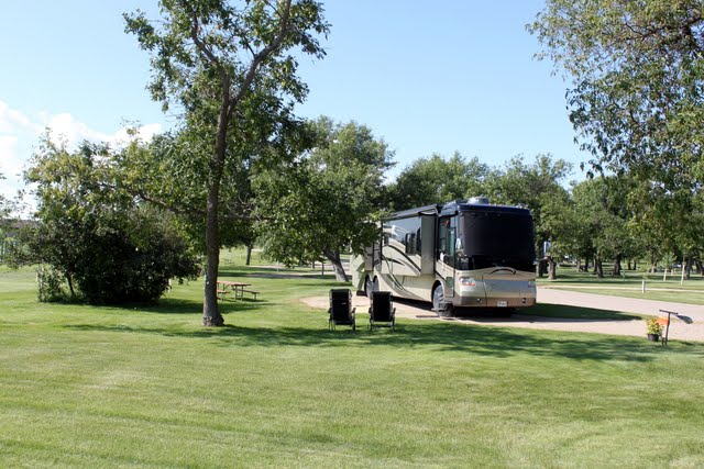 |
| Our site and Lulu getting a well deserved rest. |
 |
| Just one small part of the lake. |
 |
| Two pooped puppies after a walk on the trails. |
We are not sure how ND is going to save the areas around this lake but we sure hope they find a way. I would hate to see this park close if they couldn't contain the water over the causeway. Although the park staff told us there is only another three feet left and the lake will naturally overflow into the Sheyenne River. The issue with that is there is a town of 8,000 people below Devils Lake that would be wiped out. Our park hosts, an elderly couple who live in ND, said no one seems to be doing much about the problem and it is almost too late to stop the overflow. The weather prediction is for continued amounts of precipitation as rain or snowmelt for the next ten years..........
 |
| Trees caught in the relentless rise of the lake |
 |
| A walking path under water |
 |
| Erosion of the embankment |
 |
| Dead trees where land used to be |
 |
| A road on the island that lost to the lake |
For our triavia buffs:
We all know that North Dakota produces potatoes, wheat, and beef. But did you know they also produce soybean and what it is used for?
North Dakota produces enough soybean to make 212 billion crayons each year. I didn't even know there was soybean in crayons :)
To see more pictures go to: https://picasaweb.google.com/118305421752208972550
No comments:
Post a Comment