Monday, August 20, 2012

Forks, Washington - Home of the Vampires?


And it begins........
We arrived in Forks, WA, center of the Twilight book series and movies. If you are a fan of this genre you might enjoy it.  Although none of the movies were filmed in Forks, people supposedly come from all over the world to see the sights.

Even the local hotels get into the act.

Downtown Forks.

They offer tours.  We never did find out where the tours went to........

Twilight Central has all the info.

We were even being watched from afar.

The Miller Tree Inn is representative of the Cullen house, the residence of Edward and his vampire family.


The mailbox even has the Cullen name on it.


Three of the downtown stores with the Twilight theme.  Love their logo.


Unfortunately (?) they were all out of business.


At the Forks Visitor's Center there were replicas of the trucks Bella drove in the book series and in the movies. 


And for those of us not interested in the Twilight series (say it isn't so) there was also the Forks Timber Museum.
That about takes care of the town of Forks.  We were in the Olympic Peninsula for a week so we were able to see other more enlightening areas.  


This is Rialto Beach, part of the Olympic National Park.
It is beautiful when the sky is clear.

The beach is rugged and the trees show the effect of the wind and surf.

There are rocks of all sizes on the beach.

These big ones even have trees growing out of them.

But it definitely isn't a place to go swimming or surfing.

This area was called 'Hole in the Rock'.
 
Groups of starfish and sea urchins nestle in the rocks waiting for the tide to return.


We drove out to Cape Flattery on the Strait of Juan de Fuca, which is the most northwestern point in the contiguous United States. The strait is a large body of water about 95 miles long and is the border between the US and Canada.  It is a channel that is an outlet to the Pacific Ocean.  It extends east from the Pacific Ocean between Vancouver Island, British Columbia and the Olympic Peninsula, Washington to the Puget Sound.

Rainfall ranges from over 100 inches with a temperate rain forest condition at the west end to as little as 20 inches at the east end.  The area is exposed to the westerly winds and waves of the Pacific Ocean and is rougher than in more protected waters inland.  


On the way to Cape Flattery, we drove through a town called Sekiu where we saw this quaint harbor view.


The Cape Flattery Lighthouse in the Strait of Juan de Fuca.

The land in the background is Canada.

This is Cape Flattery.


Cape Flattery is slowing receding under the force of the pounding waves.
The sandstone is riddled with sea caves.

Within the span of several hundred more years this ground may not exist.

The Captain standing on the northwestern most point.

It was a beautiful, peaceful day.

We also took a hike through the HOH Rain Forest in Olympia National Park.  The HOH Valley receives, on average,  142 inches a year versus 34 inches in Seattle.  Amazing! 

Most of the trees had layers of moss or lichen.


We learned about nurselogs.  When a big tree falls it can provide a stage for new life. Hemlock and Spruce seedlings are unable to survive on the forest floor so they absorb warmth, minerals, and moisture from the decaying trunk.  Only a few seedlings survive.  After their roots reach soil, new trees often seem to stand on stilts as the nurselog eventually decays away.


The new trees have open spaces under them where the nurselog once lived.


The roots look like a jumbled up mess.

This new tree grew right out of the stump of another.  See all the roots of the new tree along the side reaching for the ground.

The trees in the forest were huge.

We were even able to walk under some of them along the trail. 

This tree was over 250 feet tall with a diameter of 12 1/2 feet.  The tree is 500-550 years old.

After we left the park we stopped at a river that was fed by a glacier from Mt Olympia so the pups could take a swim. 

The current was really swift.

The Smiths enjoying the view on a sunny day at the Bogachile River.
Next we follow the Strait of Juan de Fuca and head to Port Angeles and Port Townsend, Washington.  Peace!


Sunday, August 12, 2012

Destructive, Instructive, Seductive Washington State

Riffe Lake where we stayed in Taidnapam State Park
Taidnapam State Park is situated between Mt. Rainier National Park and Mt St Helens Volcanic National Monument.  As most of you will remember, Mt St Helens exploded on May 18, 1980.  But several months before, magma began rising sideways shoving the northern slope outward at a rate of five feet per day.  On May 18th, the north face of Mt St Helens collapsed in a gigantic landslide.  A hurricane-force blast of hot gas, ash, and rock erupted from the site.  The blast hugged the ground and killed trees as far away as 17 miles.  Part of this exceptional site has been set aside by Congress as a national monument for learning and research, where life could return on its own.  It was awe inspiring and scary.   


On our drive up to Windy Ridge. Mt Adams is in the background.


The blast area at Mt St Helens is still very stark.


Hard to believer 32 years have passed and we were still ten miles from the blast site.


Mt St Helens today.

Mt St Helens is the youngest and most explosive of the Cascade volcanoes.  Several eruptions were larger than that in 1980.  According to scientists, thirty-five hundred years ago she erupted producing 13 times more pumice, ash, and rock than in 1980.

Native Americans named her "Fire Mountain" and she has lived up to her name.  Scientists believe she will continue intermittent eruptions for decades before resting.  You can see where the side of the mountain collapsed.

This area is called the Pumice Plain where the landslide came down..

Tenacious plants are starting to transform this barren landscape.  Trees are now beginning to grow.

This is Spirit Lake.  Isn't it beautiful.  The lake was a recreational area used by the YMCA, Boy Scout and Girl Scout Camps, and church organizations.  It also had several lodges nestled along its 12 mile shore.  


When Mt St Helens erupted the landslide plunged into Spirit Lake raising the lake's surface 200 feet and submerging everything.

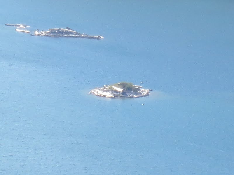
As the landslide plunged into Spirit Lake, it drove water 826 feet up the opposite ridges.  Returning waves dragged these trees, already toppled by the lateral blast, into the lake.  This is how it looks today.


Mt St Helens Lodge was destroyed by the lateral blast, then buried beneath the landscape deposit and Spirit Lake.  Above are a few of the remains with the rest of the lodge under 240 feet of water.  There is a 1.5 mile long 11-foot diameter tunnel drilled through a ridge to provide an outlet that keeps Spirit Lake at at safe level but the lake is no longer inhabitable.


At Windy Ridge we climbed up 440 steps for another panoramic view. 


A view of the Cascade Mountain Range.

Areas starting to come back naturally.

It shows how long it takes to grow a tree.

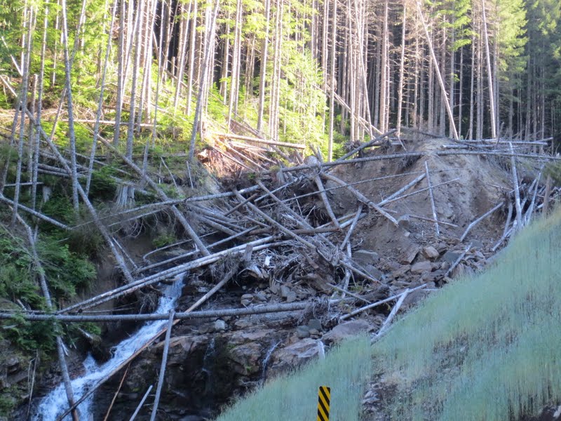
The road up to Windy Ridge was slow going.  Lots of twists and turns and areas where the asphalt was actually sloughing off the side of the mountain.  This was an area where a small landslide came down and the road had to be rebuilt including a bridge to get past it. 

Beautiful Mt Hood in the background.

Mt Adams was also in view.
The next day we went to Mt Rainier National Park.  It's a magnificent mountain standing at over 14,000 feet.


Beautiful Mt Rainier in the background as we drove into the park..


This is Box Canyon, 180 feet from the road down to the water.


Snow was still showing from all the glaciers on Mt Rainier.

You can see the small landslides in the distance.

Waterfalls were seen all along the drive.

Reflection Lake with Mt Rainier in the background.

Another view of Mt Rainier and we were only at 4,800 feet. 


Look at all the glaciers on the mountain and this was August.

Everything was green and beautiful.


The wildflowers were blooming everywhere which made the drive up even more delightful.


We stopped at Narada Falls along the drive.

The water is from the glaciers melting in the sun.  We even got a rainbow in the picture.

This is the Nisqually Glacier on Mt Rainier.  It has receded 1.5 miles in the last 150 years.

It's hard to see but there is a small river in the center from the glacier melting.

All the debris is volcanic rock that was in the glacier.

A cool man-made bridge over the Nisqually River.


Another old artifact Brett found.


We also found some hiking trails near Taidnapam and took the pups for long hikes.


This was a waterfall on Goat Creek Trail.  We were able to walk behind it and feel the misty water coming down.


A tree we saw growing under a ledge.  The top of the tree started growing horizontally when it reached the rock.


Lots of water and rugged areas where trees had fallen.

While staying in the area we also attended a Blueberry Festival at Mossyrock, WA.  


There was a parade.

This was Captain America who caught the blueberry burglar before he stole the festival.  Hey, remember this is small town America!

The Mossyback Drill Team........ladies with Dekalb drills.

Drinking blueberry beer.

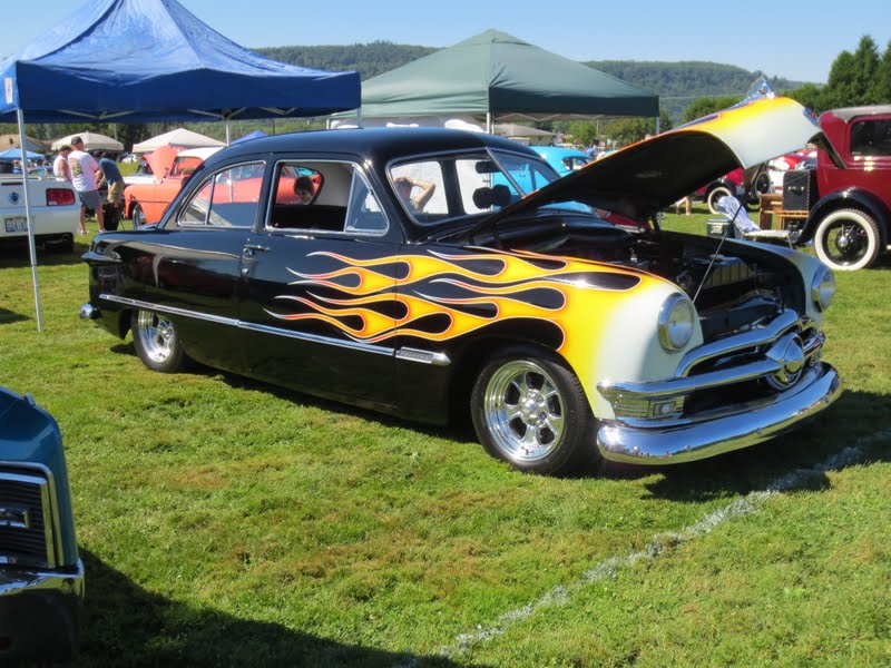
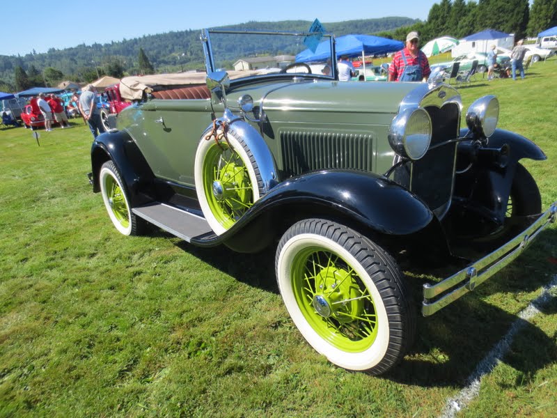
There was also an antique auto show with hundreds of beautiful revamped cars.  We have never seen so many antique cars in one place.


Another week gone and we are now heading to Forks, Washington.  Forks, you say, home of the vampires and the Twilight series?  Well the Captain booked us a week here thinking it was close to the home of some RV friends.  Wrong!  But we decided to stick it out and and explore Forks (yawn) and the Olympic National Park and other nearby sights.  Stay tuned for the next episode.......  Peace!